Credit: botlink 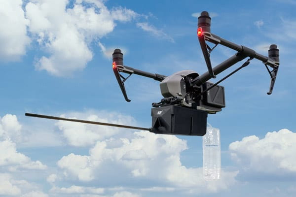
Credit: Scentroid
Taking inspiration from an aircraft’s operation such as taking off and landing independently, Unmanned Aerial Vehicles (UAVs), also known as drones, are advancing day by day due to new developments in autonomous capabilities and onboard intelligence. Like the immeasurable range of influence of Environmental Robotics, the modern scope of UAV applications is still expanding, from infrastructure inspection; to air monitoring; to precision agriculture; to search and rescue missions. As more implementations of drones are discovered and more developments are made, those progressions can be adapted to fit the needs of the environment and improve upon the work already being done.
The current systems for monitoring concentrations of toxic gases in the air are stationary, which severely limits their areas of analysis [1]. A solution to this constraint, however, is to use aerial robots (specifically, a mobile instrument platform, or MIP) to monitor and move to the source of these toxic gases, and retrieve the concentration’s co-ordinate location in the atmosphere, according to a 2020 study published in the Materials Science and Engineering Journal of the Institute of Physics Conference Series [1]. The study tested the viability and effectiveness of a gas analyzer attached to a MIP, making the robot travel in the direction of increasing gas concentration, and an algorithm of the method used for determining the coordinates of the source of pollution [1].
This study is not the only attempt to apply the advantages of aerial robots to monitoring the air; a 2017 article published in the Journal of Advanced Transportation describes a similar study wherein swarms of UAVs (rather than a single robot) were used to find and map higher concentrations of polluted areas in a rural setting [2]. This method of using swarm robotics, as well as the study’s own UAV control algorithm, proved to be more effective (map a greater polluted area over a shorter amount of time) in simulation than other models [2].
In addition to detecting and mapping the location of pollutants in the air, the third study on environmental UAVs (classified as environmental drones, or E-drones in the paper) went a step further to attempt the counter air pollution by installing onboard pollution abatement solutions [3]. These solutions entail distributing chemical processes into the air to convert the harmful toxins into non-toxic, harmless gases [3]. While this is still being tested and the E-drones are currently only equipped to diminish nitrogen dioxide in the atmosphere, this abatement solution did result in a decreased pollution concentration when it was administered [3]. Moreover, the study recommends further research into making the abatement dispensing more effective: determining optimum altitude, successful coverage area, the amount of solution required to reduce each pollutant, and the health risks of this pollution reduction method [3].
Aside from pollution-monitoring and pollution-preventing drones, it is theorized that aerial robots can also be used to indirectly affect agriculture by monitoring cloud formations and gathering data to create more accurate General Circulation Models for predicting the weather [4]. Incorrect predictions of precipitation by these models can have adverse effects; dry season crops can receive too much watering if it unexpectedly rains after they have been watered, and conversely, they can receive too little water if anticipated rain never comes [4].
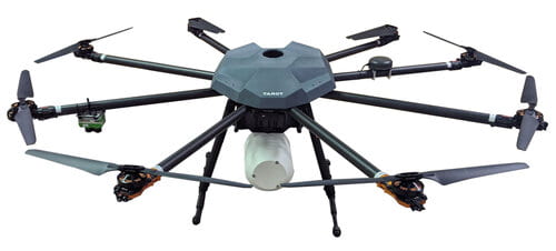
- The Botlink air quality monitoring drone was designed for mapping pollution gases and particulates. Originally designed for the US Army in Africa, the air quality drone combines off-the-shelf hardware into a powerful aerial tool. There are multiple applications for measuring the pollution content of ambient air, including urban air quality networks, industrial emission monitoring, safety monitoring, roadside monitoring, and air quality research.
- The Scentroid DR1000 & DR2000 Drone-Based Air Quality Analyzers provide a robust platform to conduct air sample collection, aerial thermal inspection, and air quality measurement for a wide range of applications including monitoring of Fugitive emission; Flare emission; Leak detection along oil pipelines; Landfill methane and odor emission.
| Ground Robotics | Marine Robotics | Industrial Robotics |
References:
[1] Atmospheric air pollution monitoring using flying robotics, R Polyakov and V Fedyanin, (2020)
[2] Using UAV-Based systems to monitor air pollution in areas with poor accessibility, Oscar Alvear et al. (2017)
[3] Autonomous monitoring, analysis, and countering of air pollution using environmental drones, Rohi et al. (2020)
[4] A unified framework for operational range estimation of mobile robots operating on a single discharge to avoid complete immobilization, Tiwari et al.(2019)